Tag
2026
17 posts
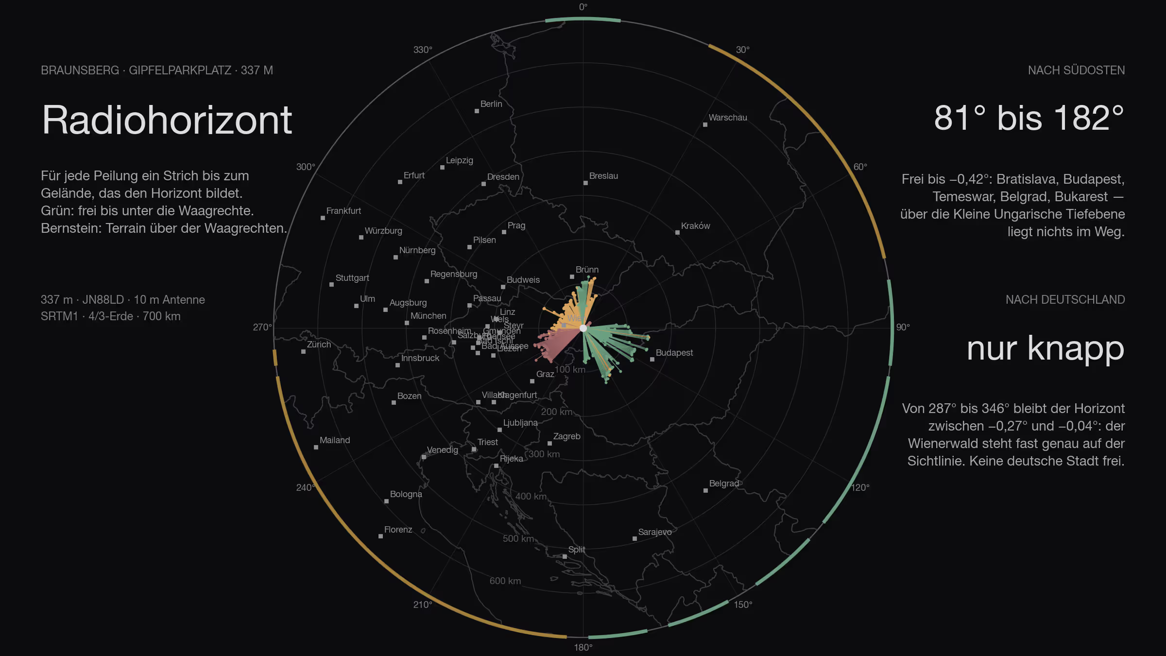
What the Braunsberg sees
A paved car park at 343 metres, right at the summit, road all the way up, eleven kilometres to Bratislava: a site can hardly be better placed. The horizon says otherwise — the south-east lies wide open, and towards Germany the Vienna Woods sit almost exactly on the line of sight.
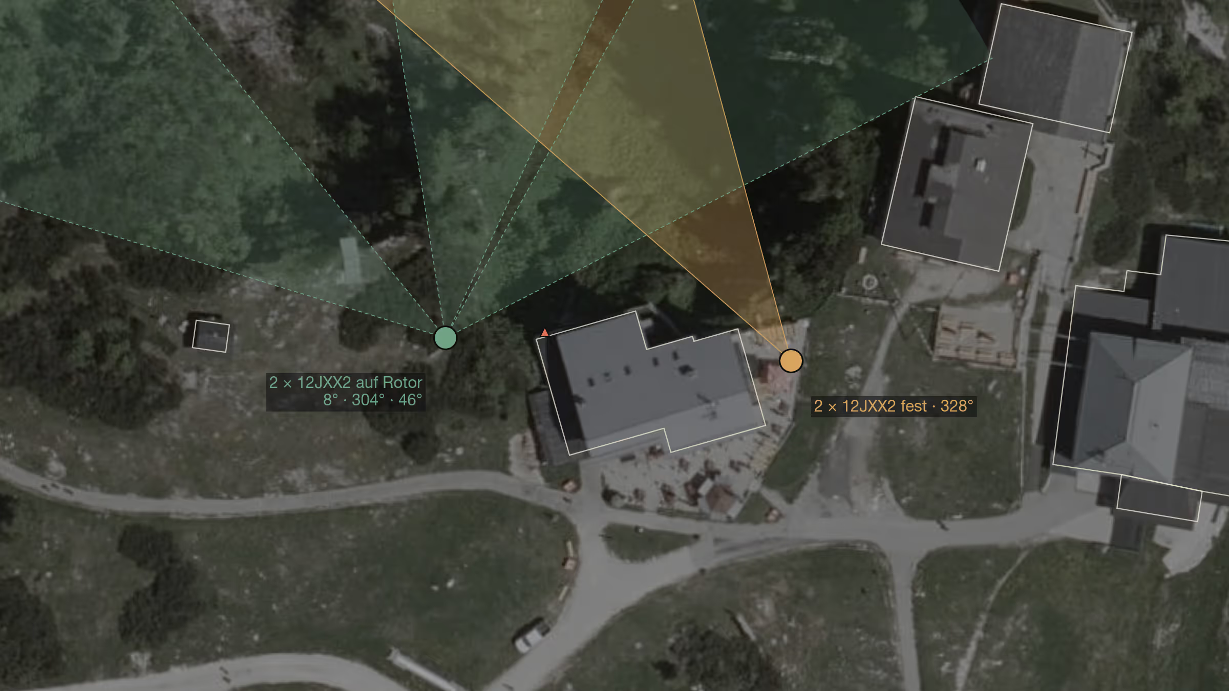
Two times two Yagis on the Feuerkogel
The horizon was calculated, so were the stations. Now the installation: two stacked 12-element Yagis, one fixed on Germany, one on the rotator — and the question of where at the Feuerkogelhaus a mast may stand at all, when people walk on the right, paragliders take off on the left and the mountain drops away behind. Plus the comparison with the Stuhleck.
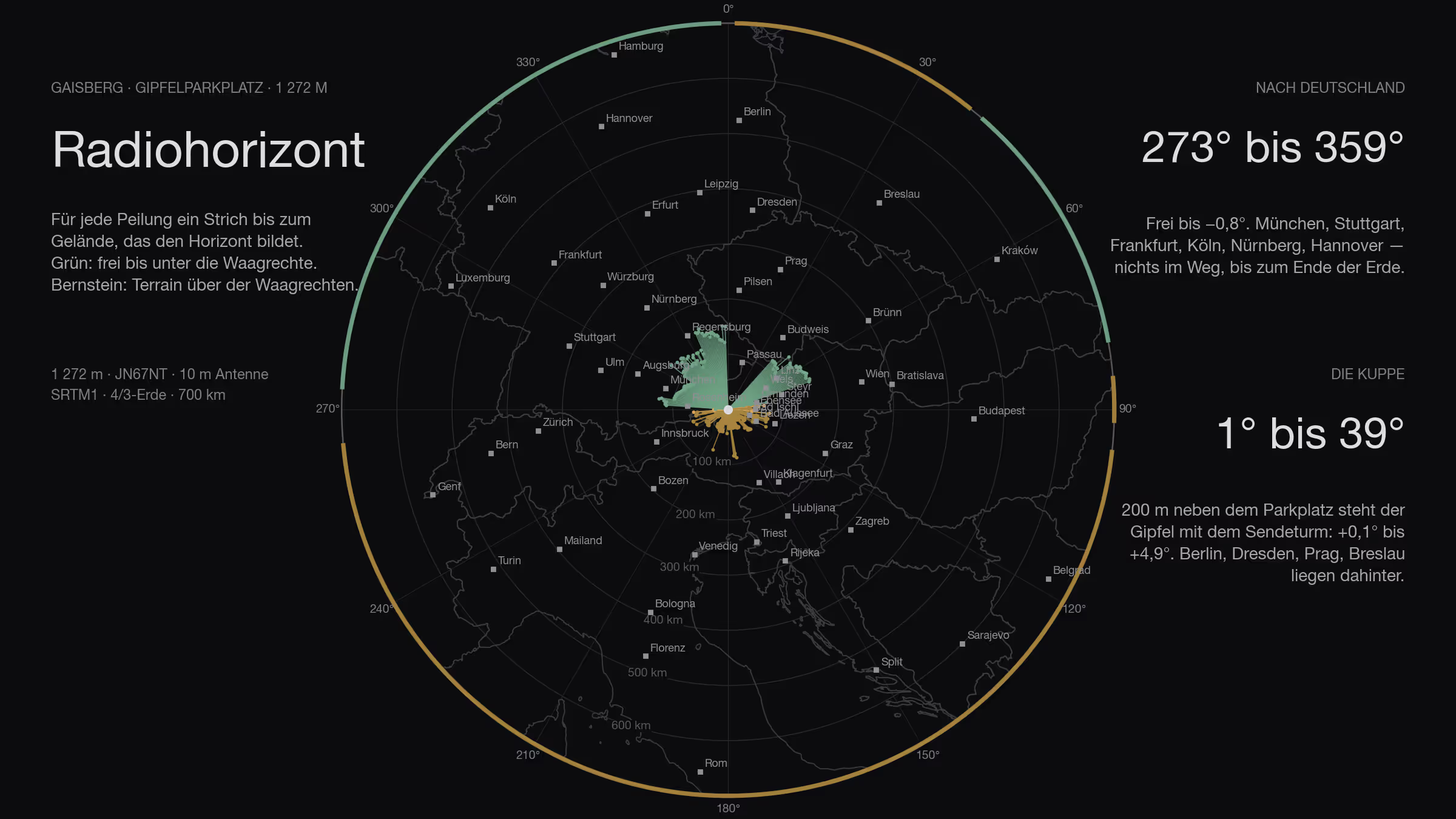
What the Gaisberg sees
The Gaisberg is the mountain you simply drive up: 1,272 metres, ten kilometres from Salzburg, a car park at the end of the road, and the view goes straight into Bavaria. I calculated it like the others — 360 bearings, the laser-scan model for the last two hundred metres, the contest logs on top. The view is good. The site is not.
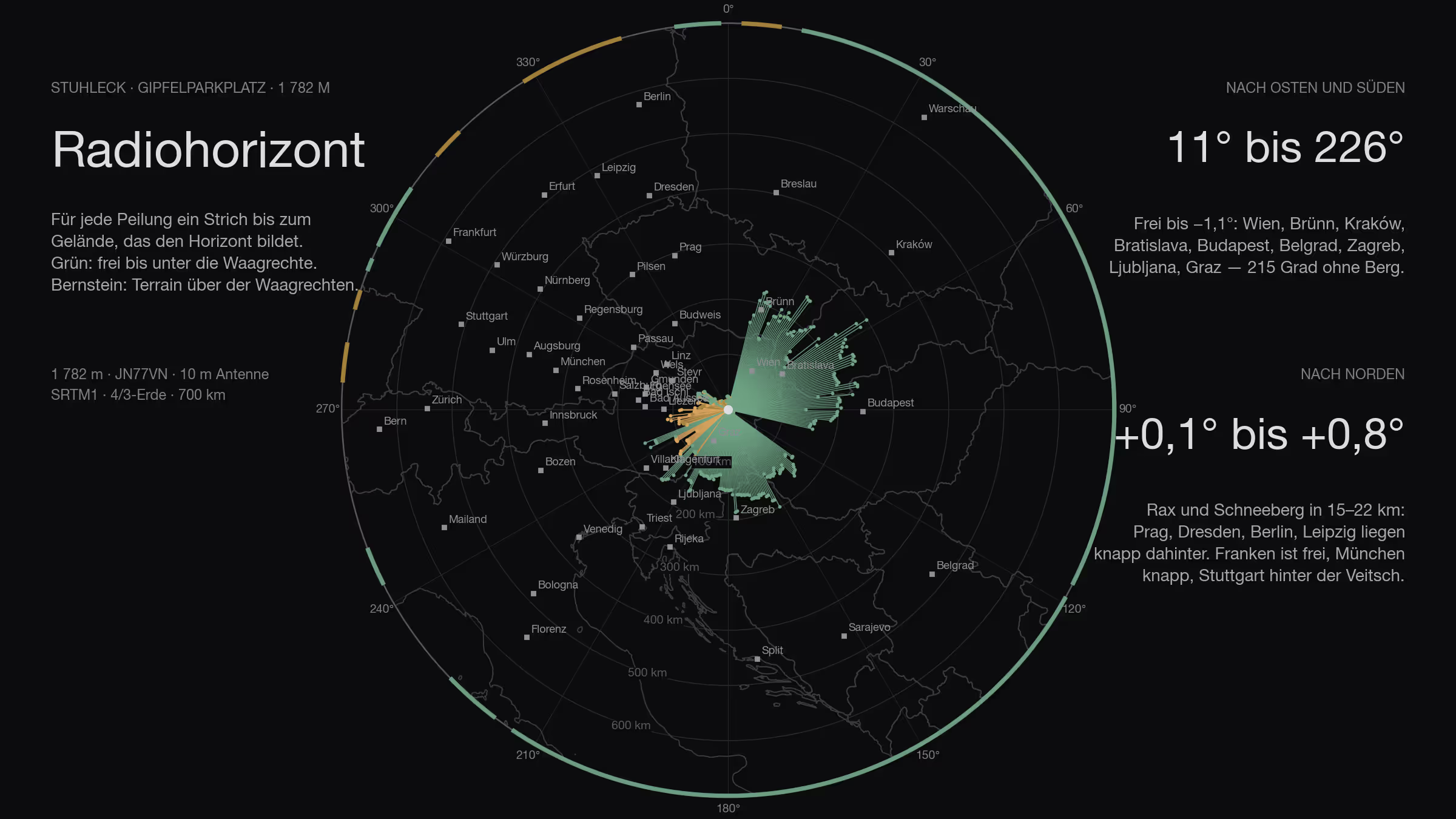
What the Stuhleck sees
The highest peak of the Fischbacher Alpen has a road up to the hut and a car park on the summit. 360 bearings, 800 kilometres, 3,215 contest logs, plus the laser scan for the hut next door — and a horizon none of the five sites before it has. Only Germany lies half behind the Rax.
Where the stations really are
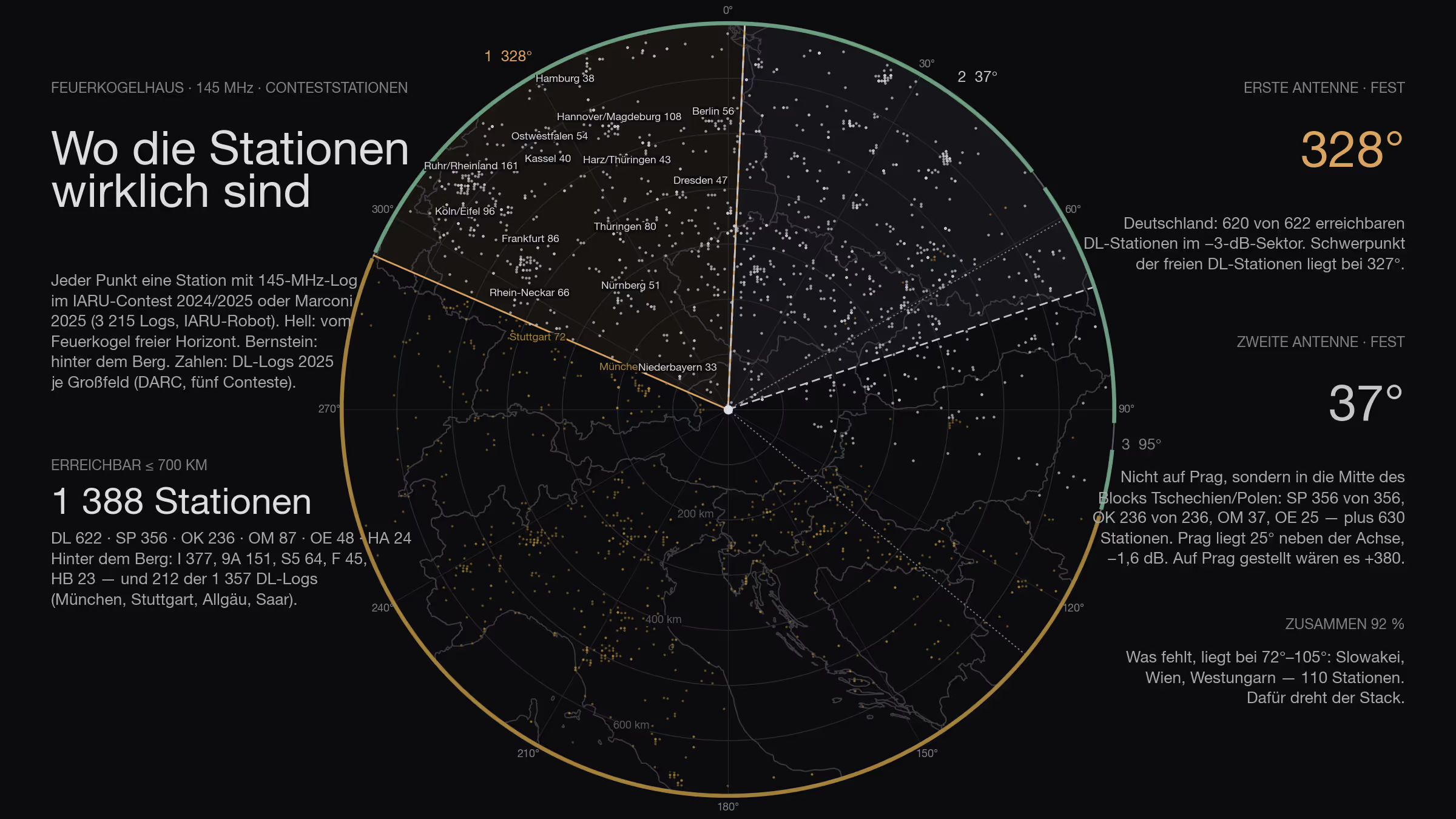
The horizon was the first question, the other stations are the second. 3,215 contest logs from two years say where the antennas on the Feuerkogel have to look — and why the second one does not point at Prague.
What the Grünberg sees
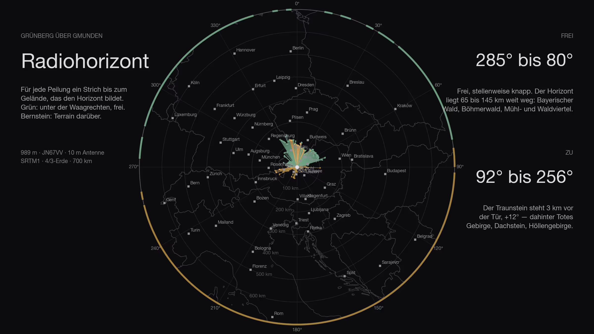
Gmunden's local mountain, 989 metres, a hundred metres west behind the inn: the same calculation as for the Feuerkogel. The Traunstein stands three kilometres away and closes half the circle — the other half is open all the way to Bavaria and Bohemia.
What the Hochkar sees
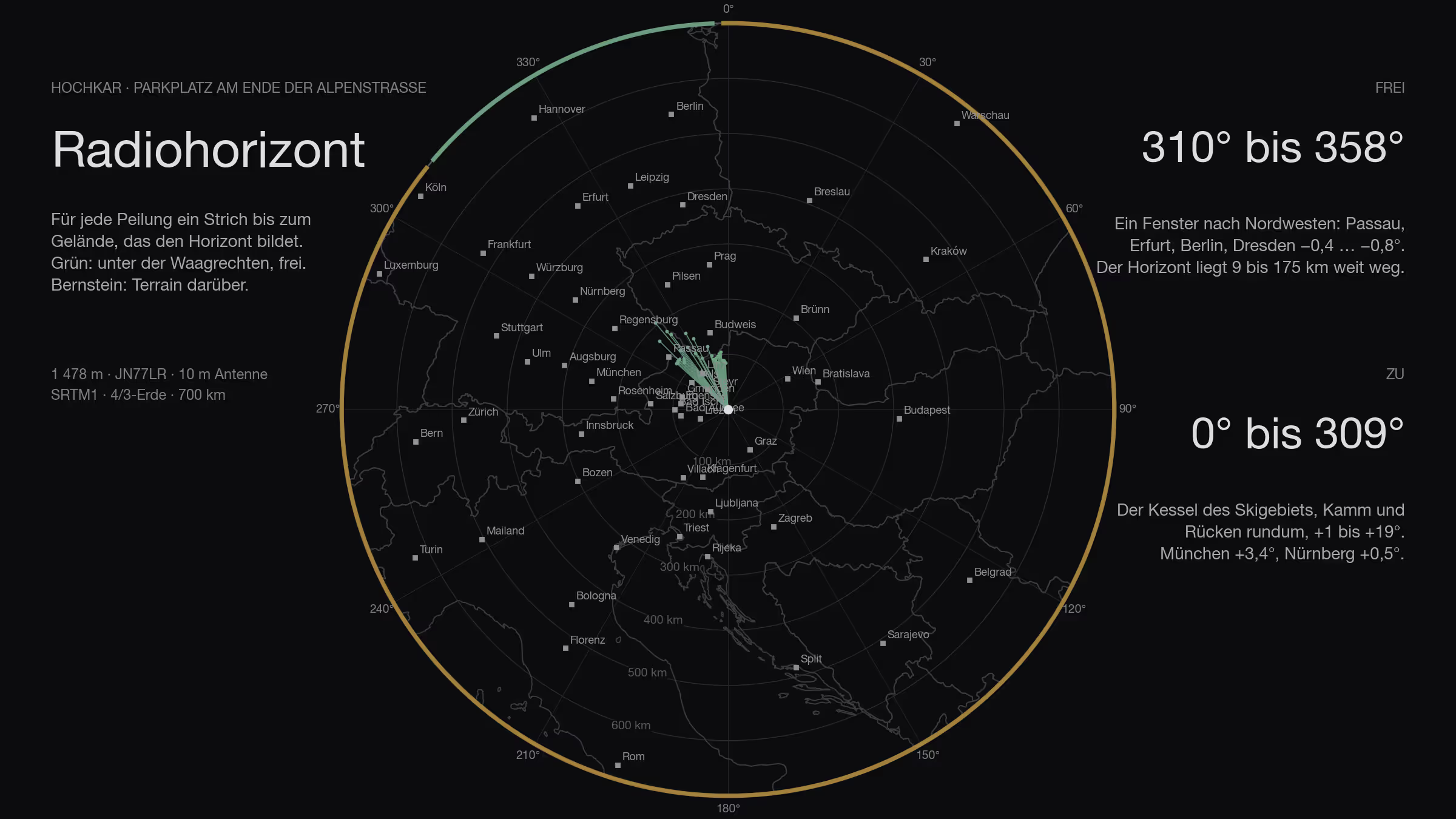
The Hochkar Alpenstraße ends at 1,478 metres — the highest point in Lower Austria you can reach by car. From there, there is exactly one window: 48 degrees wide, to the north-west, deep. Everything else is the bowl of the ski area.
What the Loser sees — and what it doesn't
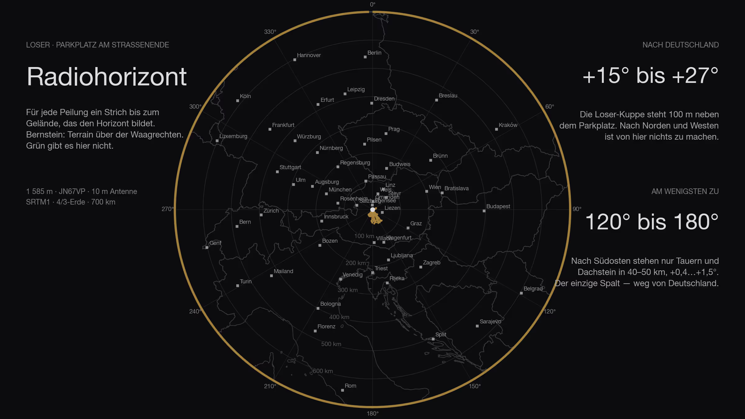
The car park at the end of the Loser Panoramastraße lies at 1,585 metres, and still it is closed all round. I calculated the whole road, both car parks, both top stations and the summit, plus the contest logs: who could be reached from there. Only one of them looks towards Germany, and you have to walk to it.
What the Traisner Hütte sees
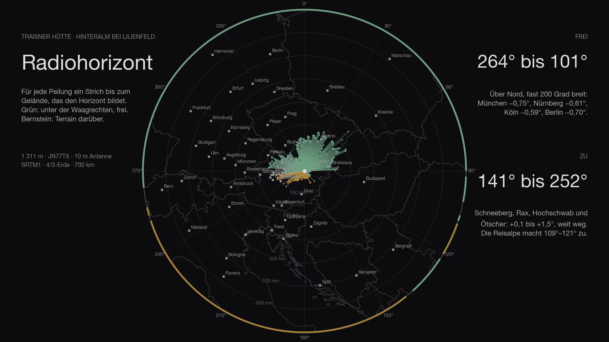
The fifth site, and the first with no hole towards Germany: the Traisner Hütte on the Hinteralm above Lilienfeld, 1,311 metres. From 264° over north to 101° nothing stands in the way — Munich, Nuremberg, Cologne, Berlin, all below the horizontal. Only the south is closed, and the south is far away.
What the Feuerkogel sees
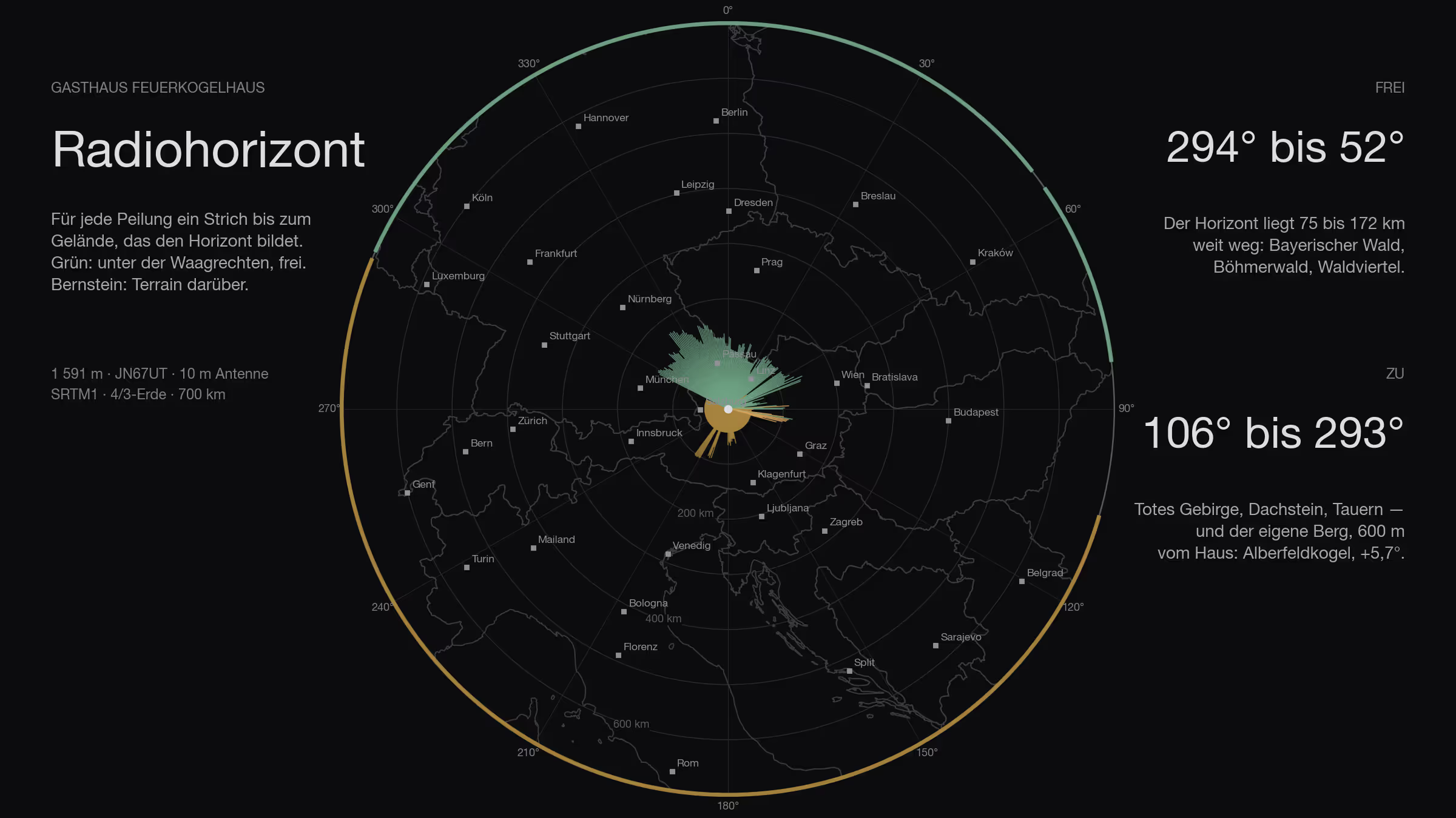
Before a contest station goes up a mountain, you should know which way the mountain looks. For the Gasthaus Feuerkogelhaus I worked it out: 360 bearings, 800 kilometres, every peak that stands in the way — and the direction where none does.
Santa Magdalena, Mallorca
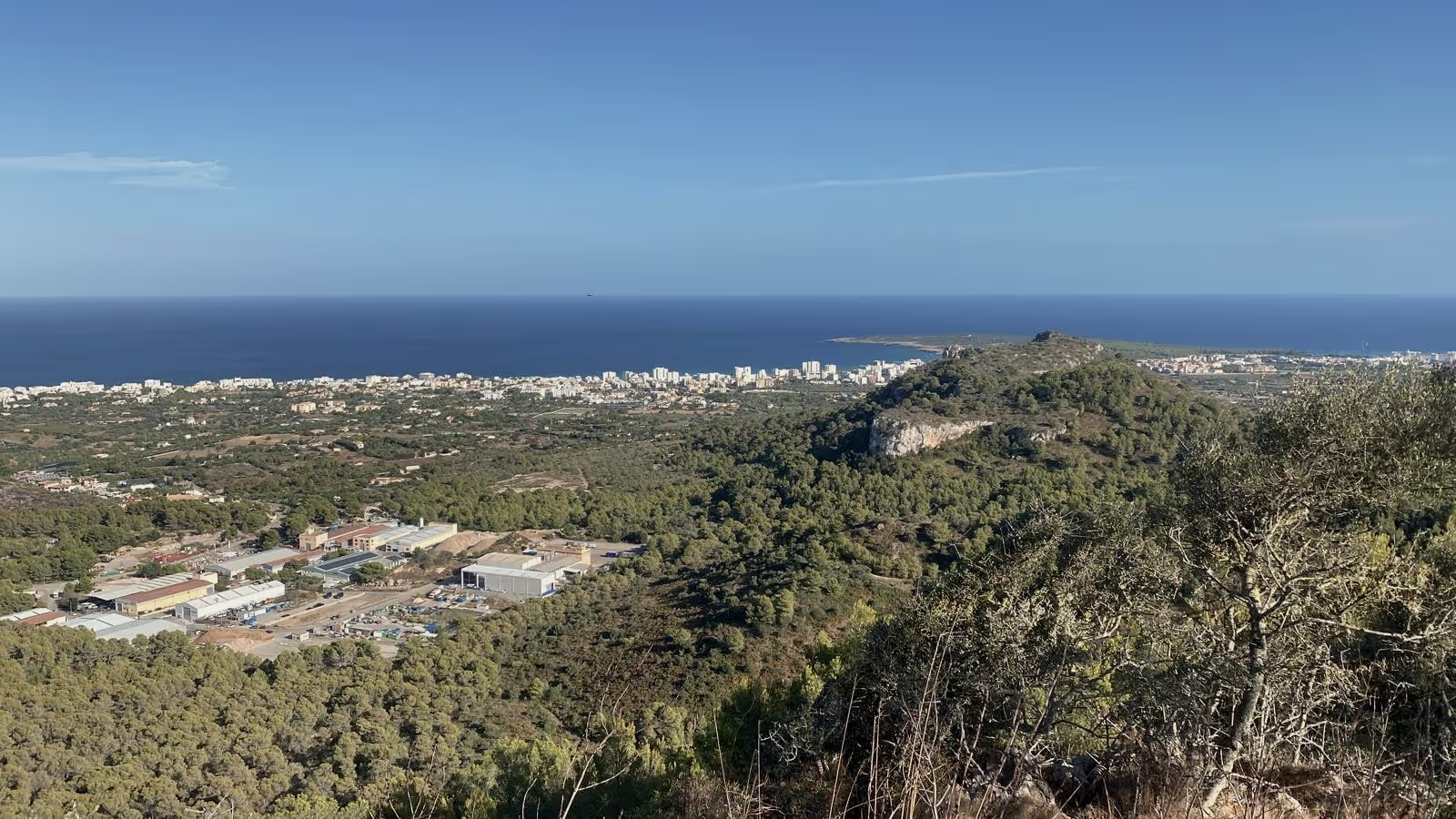
A small hill above Inca, 305 metres, two points — and the IC-705 in the backpack. Twelve SSB contacts, from Andalusia to Moldova.
Contest weekend at OE1W
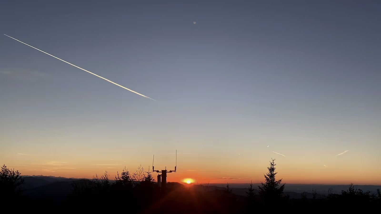
Back at the Traisnerhütte, back for twenty-four hours of the IARU Region 1 VHF contest — this time a few hours at the rig myself. Glorious weather, conditions you wish for, longest QSO 1,005 kilometres.

The two radios I write the software for
Two boxes on the same desk, about the same size, both hooked up over LAN — and yet two completely different relationships to the software.
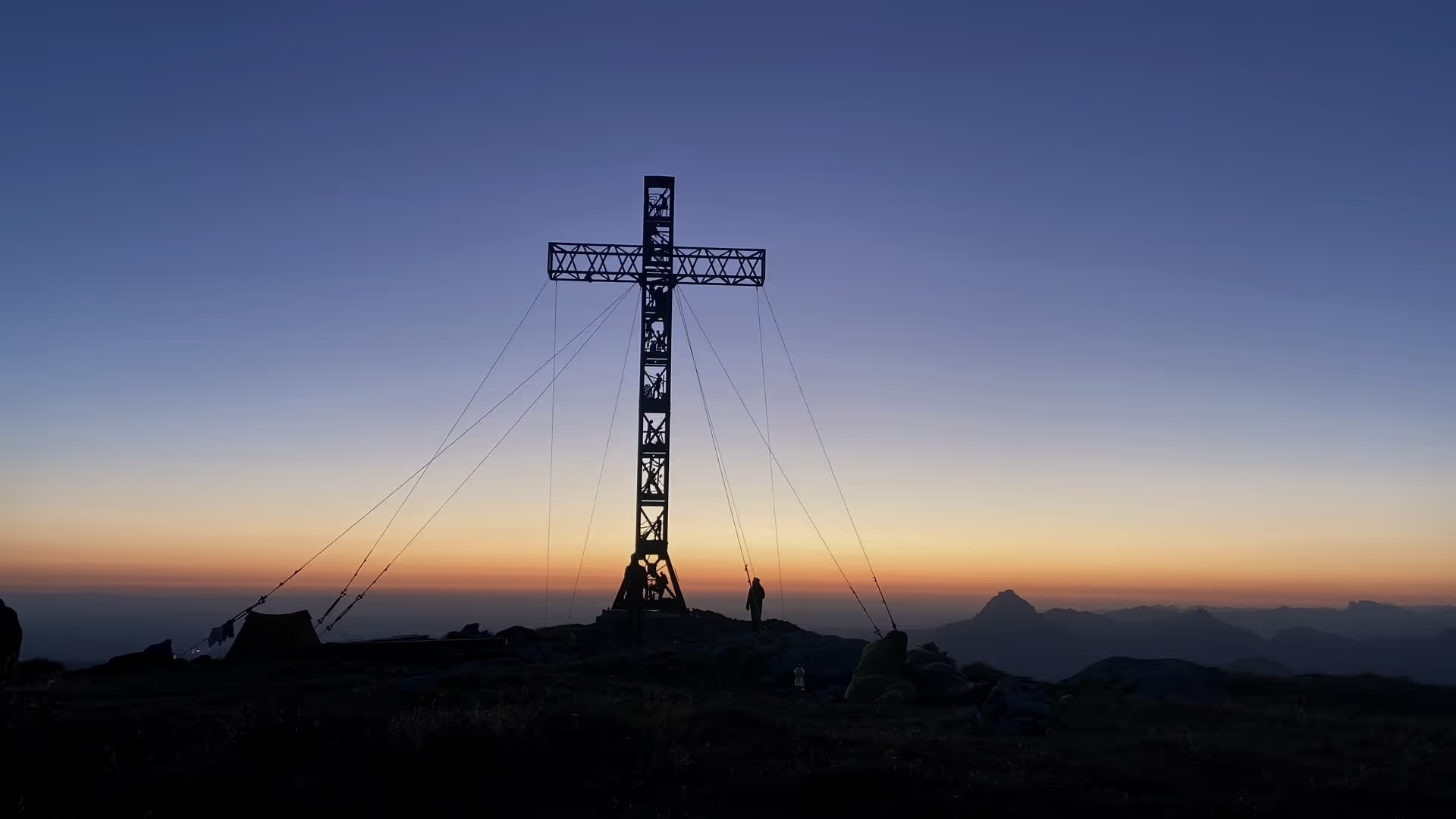
Crossing the Höllengebirge, with a night on the summit
Three summits along the ridge, each higher than the last. Staying up top instead of descending — and getting the same light twice, from both sides of the day.
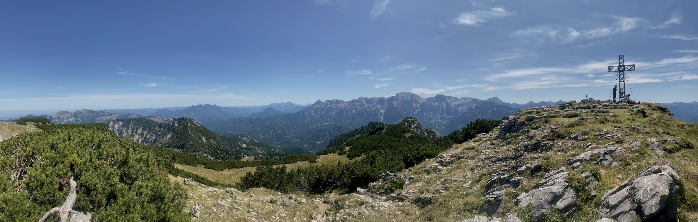
Schwalbenmauer and Kasberg in one day
23 kilometres in 5:30 hours, two summits, perfect weather — and an approach that's on no sign anywhere.
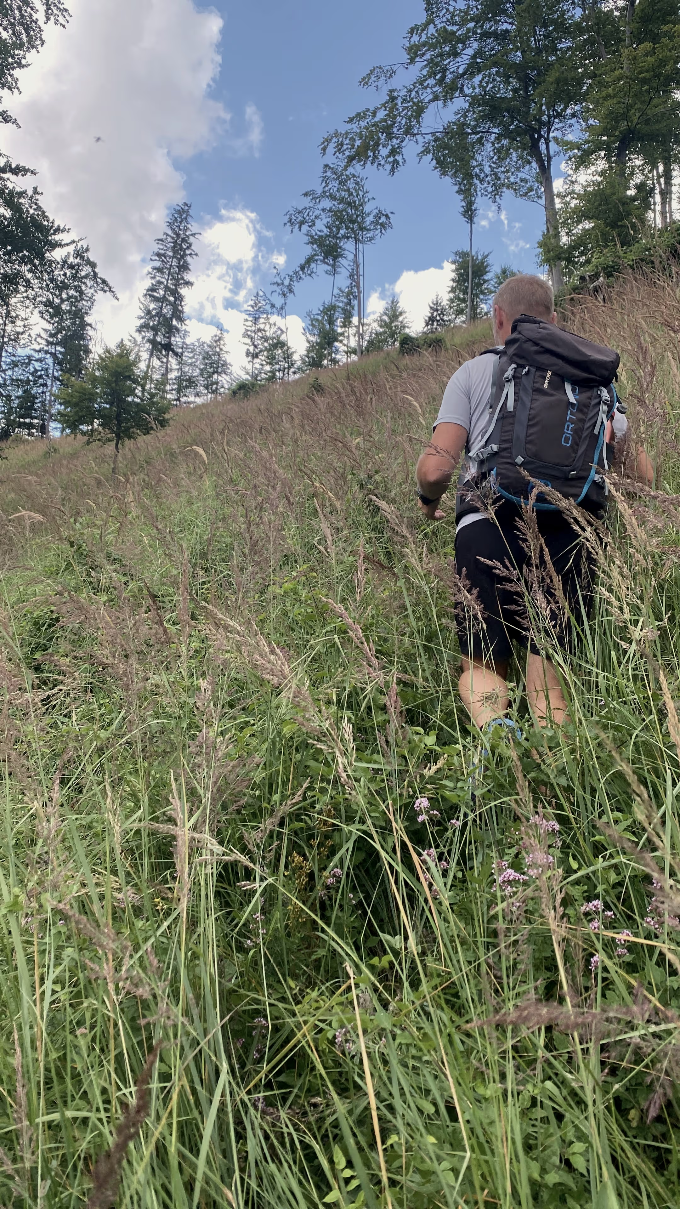
Windhagkogel — grass up to the hip
1,334 metres, poorly signposted, and in the tall grass there was nothing left to see of the actual path. Then two minutes of hail on the summit.
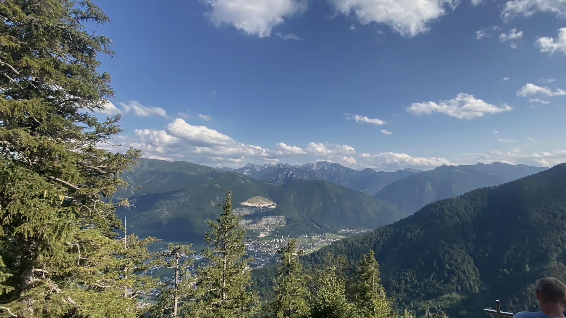
Brenntenkogel above Ebensee
1,135 metres, four points, and a path that stops being one near the top. Raspberries as far as the arm reaches, though.